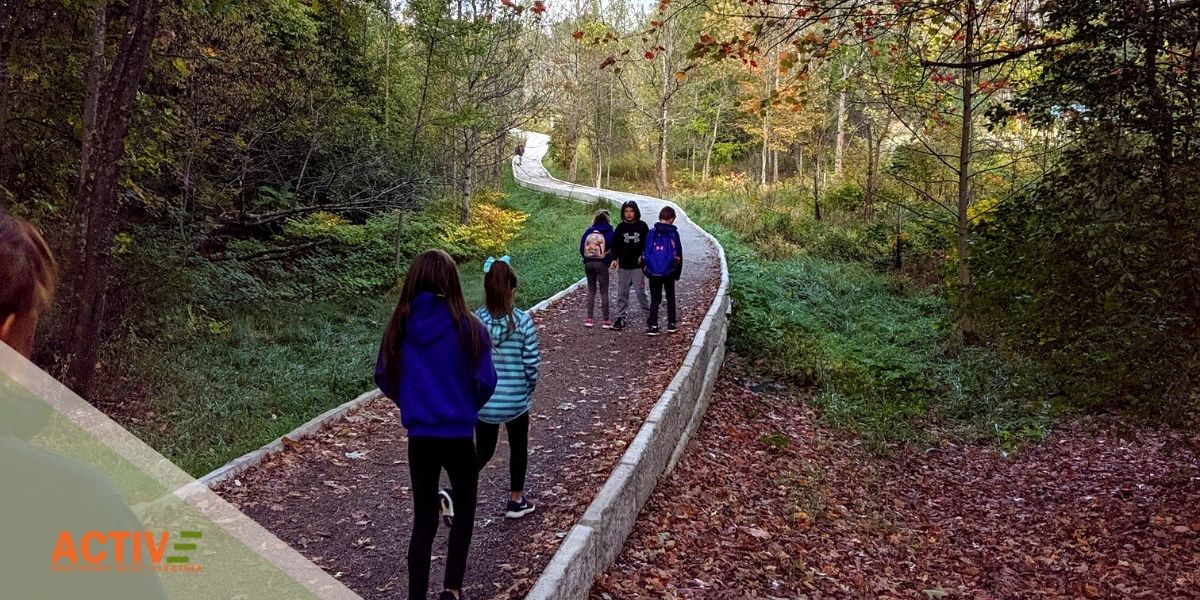
It can be challenging to get kids outside and active in the colder winter months, but Active SWV is here to help. We’ve put together a January hiking and plant scavenger hunt challenge to get you excited to hit the trails. Read through the following sections to see how it works.
Trail recommendations
Grandview Area Trails
- Big Buck Trail: LENGTH: 0.9 miles/1.45 km (round trip). DIFFICULTY: Easy. TRAIL TYPE: Hiking only. This easy 0.9 mile trail loops through a rolling section of forest. Tree identification signs along the way celebrate the great diversity of flora found in the Appalachian forest.
- Grandview Rim Trail: LENGTH: 1.6 miles/2.57 km (One-way). DIFFICULTY: Moderate. TRAIL TYPE: Hiking only. This is the longest trail at Grandview, connecting Main Overlook with Turkey Spur. From Main Overlook to Turkey Spur is a moderate 1.6 mile hike (3.2 miles round trip). Along the way hikers will enjoy many breathtaking views of the gorge and river far below.
Thurmond, Stone Cliff, and Cunard area trails
Again, there are more trails listed on the NPS page for this area. All descriptions found below were also copied from that page.
- Stone Cliff Trail: LENGTH: 2.7 miles/4.35 km (One-way). DIFFICULTY: Easy to Moderate. TRAIL TYPE: Hiking and biking. This moderate 2.7 mile trail follows an old road along the banks of the New River. Great views and easy access to the river are available along this trail.
- Rend Trail: LENGTH: 3.4 miles/5.47 km (One-way). DIFFICULTY: Easy. TRAIL TYPE: Hiking and biking. An easy grade and wide, smooth trail make the Rend Trail one of the most popular trails in the park. It is great for hikers of all ages and levels of fitness, and a great start for beginning mountain bikers.
Sandstone/Brooks area Trails
See more trails on the NPS page for this area. All descriptions below are copied from that page.
- Sandstone Falls Boardwalk: LENGTH: 0.2 miles/0.32 km (One-way). DIFFICULTY: Easy. TRAIL TYPE: Hiking and accessible. Sandstone Falls is a sight that should not be missed. This is the largest waterfall on the New River spanning 1500 feet across. Divided by islands, the falls drop from 10 to 25 feet. A ¼ mile, handicapped accessible boardwalk crosses two bridges leading to islands and observation decks offering fantastic views of the falls and access to fishing areas.
- Island Loop Trail: LENGTH: 0.5 miles/0.8 km (Round-trip). DIFFICULTY: Easy. TRAIL TYPE: Hiking only. The Island Loop Trail is an easy ½ mile trail that loops around the largest island below Sandstone Falls. The island was once farmed, grazed, and timbered, and a grist mill once operated here. Today, hikers can observe the natural succession as the old fields transition back to forest.
Fayetteville Area Trails
See the NPS page for more trails in this area. Again, all descriptions below were copied from the NPS page.
- Kaymoor Trail: LENGTH: 8.6 miles/13.84 km (One-way). DIFFICULTY: Moderate. TRAIL TYPE: Hiking and biking. The Kaymoor Trail runs parallel with the middle of the gorge, passing the historic coal mine site at Kaymoor. The northern two miles of the trail, from Wolf Creek trailhead to the old mine site, follows an old road. Wayside exhibits interpret the Kaymoor mine operation and community along the way.
- Bridge Trail: LENGTH: 0.86 miles/1.38 km (one way). DIFFICULTY: Strenuous. TRAIL TYPE: Hiking only. This occasionally steep and rocky trail offers views of the gorge and the New River Gorge Bridge. The trail passes under the bridge and connects to the Fayetteville Trail.
Scavenger hunt – native and invasive plants
So you have a place to hike – now what? Here’s where the plant scavenger hunt comes in! While you’re out on the trails, why not be on the lookout for native and invasive plants?
The following definitions of ‘native’ and ‘invasive’ plants can be found on this USDA webpage.
Native plants – A plant that is a part of the balance of nature that has developed over hundreds or thousands of years in a particular region or ecosystem
Invasive plants – A plant that is both non-native and able to establish on many sites, grow quickly, and spread to the point of disrupting plant communities or ecosystems
With that in mind, look out for the following particular native and invasive plants in the New River Gorge region.
New River Gorge native plants:
- American holly (Ilex opaca)
- wintergreen (Gaultheria procumbens)
- mountain laurel (Kalmia latifolia)
- rhododendron (Rhododendron maximum)
- greenbrier (Smilax spp.)
- striped maple (Acer pensylvanicum)
- Canadian hemlock (Tsuga canadensis)
- shagbark hickory (Carya ovata)
- white pine (Pinus strobus)
New River Gorge invasive plants:
- Japanese barberry (Berberis thunbergii)
- multiflora rose (Rosa multiflora)
- Asian bittersweet (Celastrus orbiculatus)
- burning bush (Euonymus alatus)
- autumn-olive (Elaeagnus umbellata)
- Japanese honeysuckle (Lonicera japonica).
Use the iNaturalist App
So you’re hiking on a trail, and you see a plant, but you’re not 100% sure that it’s one of the plants on the scavenger hunt native and invasive list. This is where the iNaturalist App comes in.
One of the world’s most popular nature apps, iNaturalist helps you identify the plants and animals around you. Get connected with a community of over a million scientists and naturalists who can help you learn more about nature! What’s more, by recording and sharing your observations, you’ll create research quality data for scientists working to better understand and protect nature. iNaturalist is a joint initiative by the California Academy of Sciences and the National Geographic Society.
The New River Gorge National Park and Preserve uses data uploaded within the park to track vegetation growth, identifying invasive species, tracking pollinators, and recording erosion.
With this app, you will be equipped with a tool to use when out on walks and hikes in the outdoors.
You can download the app here.
Here are some video resources to get you started using the iNaturalist App:
Enjoy the outdoors! Don’t forget to tag #ActiveSWV in any photos you post of your outdoor adventures.
Be sure to check our website calendar for a list of hikes and other group activities you can join in on for free every week.